

The standard Ha Giang Loop on Highway QL4C is spectacular, but for experienced riders and seasoned mountain trekkers, it is only the entrance. Beyond the paved highway lies Ha Giang’s true wilderness: unpaved border patrol tracks along the Chinese frontier, steep limestone single-track passes, and multi-day jungle routes cut into the slopes of Tay Con Linh.
What defines an « Adventurous Route » in Northern Vietnam?
In Ha Giang, adventure is not a marketing term – it is a function of terrain, isolation, and road conditions. Standard tour buses and automatic scooters never touch these tracks.
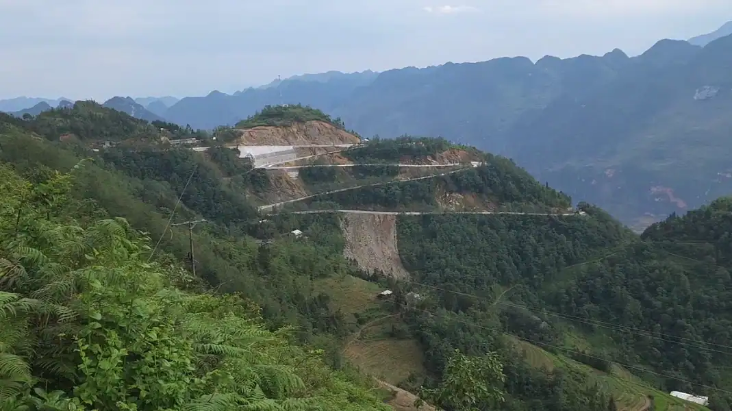
- Elevation profiles: Routes ascent from 200 meters in river valleys to over 1,500 meters across single passes, creating sharp temperature drops and sudden cloud shifts.
- Surface variability: Paved asphalt gives way to loose limestone gravel, wet red clay, riverbed stone crossings, and unreinforced single-track ledges.
- Service distance: Fuel stations, mechanical repair shops, and mobile phone coverage can be 40 to 60 kilometers apart.
- Rider & hiker demands: Requires active body weighting on motorcycles (standing on pegs) or sustained quad endurance on 30% to 40% incline hiking trails.
« When riders tell me they want ‘real adventure’ in Ha Giang, I take them off Highway QL4C. True mountain wilderness starts where the asphalt ends – on the border ridge of Sam Pun or the muddy inclines of DT177. If you are prepared for mud, gravel, and absolute solitude, these routes will stay with you for a lifetime. » – Văn Trung Nguyễn, TVPalm Adventure
The 5 most adventurous routes in Ha Giang compared
| Route Name | Key Region | Length | Surface Type | Risk Rating | Ideal Vehicle / Format |
|---|---|---|---|---|---|
| 1. Sam Pun Border Pass Circuit | Meo Vac – Chinese Frontier | 28 km | Broken concrete & loose gravel | 9/10 (Expert) | 150cc+ Dual-Sport (Honda XR150) |
| 2. Hoang Su Phi Dirt Circuit (DT177) | Tan Quang – Hoang Su Phi | 105 km | Dirt, clay, loose stone | 8/10 (Advanced) | 150cc Manual or 4WD SUV |
| 3. DT176 Meo Vac to Du Gia Pass | Meo Vac – Mau Due – Du Gia | 48 km | 15 km unpaved karst gravel | 7/10 (Intermediate+) | 125cc+ Manual or 4WD |
| 4. Ma Pi Leng Sky Path Cliff Trek | Meo Vac – Tu San Canyon | 5.5 km (foot) | Exposed limestone ledge trail | 8/10 (Trekking) | High-ankle trekking boots |
| 5. Quan Ba to Tung Ba Forest Track | Quan Ba – Vi Xuyen | 52 km | Mud, rock, jungle track | 8.5/10 (Advanced) | 150cc Dual-Sport or Guided Trek |
Detailed breakdown of the top 5 routes
Route 1: Sam Pun Border Pass Circuit (Meo Vac to Chinese Frontier)
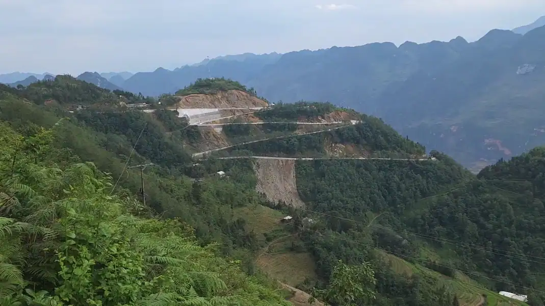
The Sam Pun Pass is widely recognized by local riders as the steepest asphalt and broken-concrete switchback descent in northern Vietnam. Starting near Meo Vac town, this 28-kilometer route drops down toward the Nho Que River before climbing sharply along Border Marker 456 on the Sino-Vietnamese frontier.
- Distance: 28 km one-way (56 km round trip from Meo Vac)
- Technical challenge: 14 sharp hairpin switchbacks with gradients exceeding 22%. Narrow track (2.5 meters wide) with no guardrails along a 600-meter drop.
- Surface: Broken concrete, loose limestone gravel, sand on sharp corners.
- Highlights: Unobstructed views into China’s Guangxi province, zero commercial tourism, dramatic views of Nho Que River from the eastern rim.
- Rider warning: Brakes must be in 100% working order. Engine braking in 1st gear is mandatory on the descent. Automatic scooters are strictly prohibited by local guides due to rapid brake fade risk.
For map orientation and route planning across the broader region, refer to our comprehensive Ha Giang Loop Map Guide.
Route 2: Hoang Su Phi Terraces & DT177 Dirt Circuit
Located west of Ha Giang City, Hoang Su Phi is famous for National Heritage terraced rice fields cut into 1,500-meter peaks. The main artery, Provincial Road DT177, is legendary among off-road riders for its extreme mud conditions during the rainy season and deep rutted gravel during dry months.
- Distance: 105 km from Tan Quang (QL2 junction) to Hoang Su Phi town
- Technical challenge: Continuous road construction, heavy landslide debris, deep ruts, wet clay slumping during monsoon months (June–August).
- Surface: 40% unpaved red dirt/clay, 40% crushed stone, 20% deteriorating asphalt.
- Highlights: UNESCO-grade rice terraces at Ban Luoc and Phung Village, ethnic Red Dao homestays, views of Tay Con Linh peak (2,427 meters).
- Traveler tip: If traveling by car, only high-clearance 4WD vehicles (Toyota Land Cruiser, Hilux) should attempt DT177 after rain. See our full comparison on traveling the Ha Giang Loop by Car or Motorbike.
Route 3: DT176 Mau Due to Du Gia Karst Pass
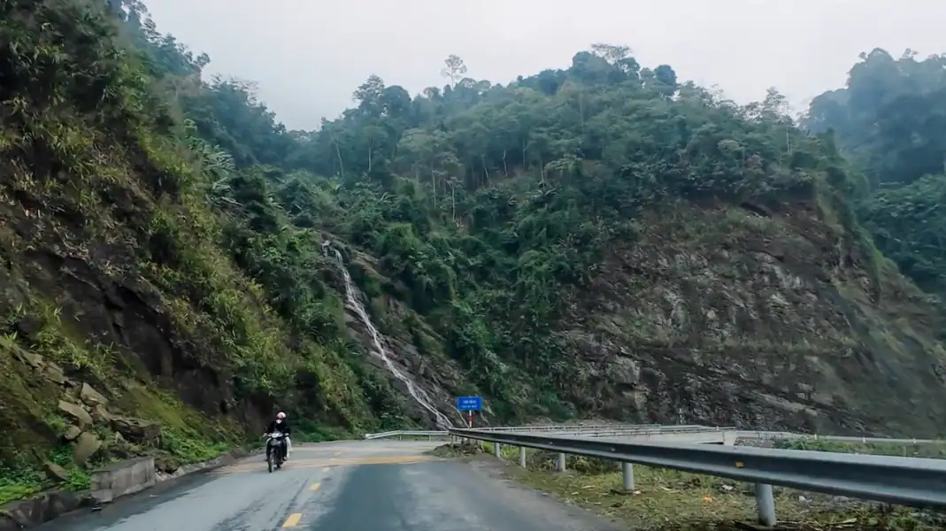
While parts of the standard loop are fully paved, the 48-kilometer stretch connecting Mau Due to Du Gia via Provincial Road DT176 features a 15-kilometer section of raw limestone gravel and mountain river crossings.
- Distance: 48 km
- Technical challenge: 15 km unpaved section with football-sized limestone boulders, riverbed runoff, steep 14% inclines near Du Gia Pass (1,200m altitude).
- Surface: Loose karst gravel, embedded rocks, mud patches near mountain springs.
- Highlights: Panoramic views over Du Gia valley, crystal-clear natural swimming pools at Du Gia Waterfall, authentic Tay minority stilt house homestays.
- Vehicle match: Manual 125cc–150cc motorcycles perform best. Easy Rider pillion passengers can ride this route with experienced drivers.
Route 4: Ma Pi Leng Sky Path Cliff Trek
For travelers seeking adventure on foot rather than on wheels, the Ma Pi Leng Sky Path is Ha Giang’s premier cliffside hiking trail. Carved directly into the vertical limestone walls of Ma Pi Leng Pass, this 5.5-kilometer trail hangs hundreds of meters above the emerald waters of the Nho Que River.
- Distance: 5.5 km point-to-point hike
- Technical challenge: Narrow 1-meter-wide trail along sheer cliff edges, 450 meters cumulative elevation gain, steep stone steps.
- Surface: Uneven limestone rock, dirt paths, natural stone staircases.
- Highlights: The « White Rock » (Đá Trắng) viewpoint, bird’s-eye perspective of Tu San Canyon (1,000m depth – Southeast Asia’s deepest canyon), traditional H’Mong hamlets perched on cliffs.
- Trekking advice: High-ankle boots with aggressive rubber tread are essential. Do not attempt in heavy rain or dense fog when limestone rocks become slick as ice.
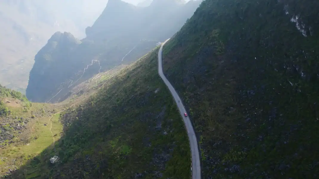
Route 5: Quan Ba to Tung Ba Primary Forest Corridor
This remote 52-kilometer jungle corridor connects Quan Ba District to Vi Xuyen District through the buffer zone of the Khau Ca Species and Habitat Conservation Area. This ecosystem shelters the critically endangered Tonkin snub-nosed monkey (Rhinopithecus avunculus).
- Distance: 52 km
- Technical challenge: Narrow single-track dirt trails under dense forest canopy, steep slippery clay slopes, stream crossings without bridges.
- Surface: Wet forest topsoil, exposed roots, sharp limestone outcrops.
- Highlights: Intact primary tropical rainforest, ancient Shan Tuyet tea trees, rare wildlife habitat.
- Permit notice: Part of this route borders restricted conservation land. Escort by a licensed local guide or ranger is required for safety and environmental compliance.
Seasonal road & Hazard guide
Navigating Ha Giang’s adventurous routes safely requires matching your expedition dates with seasonal weather patterns.
| Month | Season | Weather & Road Surface Conditions | Adventure Risk Rating |
|---|---|---|---|
| Jan – Feb | Winter | Cold (5°C–12°C), dense freezing fog, slick roads, limited visibility on passes | High (Visibility risk) |
| Mar – Apr | Spring | Mild temperatures (18°C–25°C), dry roads, clear mountain passes, blooming flora | Moderate (Optimal for riding) |
| May – Jun | Pre-Monsoon | Warm (24°C–32°C), occasional heavy thunderstorms, flash mud on DT177 | Moderate to High |
| Jul – Aug | Monsoon | High rain, frequent landslides, washed-out dirt tracks, river overflow | Extreme (High off-road risk) |
| Sep – Oct | Harvest Season | Ideal conditions (20°C–28°C), dry firm dirt, golden rice terraces in Hoang Su Phi | Moderate (Best for photography) |
| Nov – Dec | Early Winter | Cool, dry, clear skies, low humidity, cold nights at altitude (8°C) | Low to Moderate |
Off-Road & Backcountry expedition checklist
- Vehicle Check: Dual-sprocket chain tension, front/rear brake pad thickness (>3mm), knobby tire tread, working headlight/fog lights.
- Rider Protective Gear: DOT/ECE full-face helmet, armored riding jacket, elbow/knee guards, high-ankle boots, waterproof gloves.
- Emergency Repair Kit: Spare inner tubes (18″ & 21″), tire levers, compact hand pump, chain lube, master link, multi-tool, heavy-duty zip ties, wire.
- Navigation & Comm: Offline GPX maps downloaded (Maps.me / Organic Maps), local Viettel SIM card (strongest mountain coverage), fully charged 20,000mAh power bank.
- First-Aid & Survival: Compression bandages, antiseptic wipes, pain relievers, hydration tablets, emergency foil blanket, headlamp, 2 liters emergency water.
- Permits & Docs: Original passport, valid 1968 Convention IDP + home country motorcycle license, Vietnam Border Zone Entry Permit (obtained in Ha Giang City).
FAQ
Can I tackle these adventurous routes on a standard automatic scooter?
No. Automatic scooters (such as a Honda Vision or Air Blade) are strictly unsuitable and unsafe for Ha Giang’s off-the-beaten-path routes like Sam Pun Pass or DT177. Automatic scooters lack engine braking, which leads to rapid brake overheating and catastrophic failure on steep continuous descents (up to 22% gradient). Furthermore, small 10-inch scooter wheels cannot negotiate loose limestone gravel or deep mud. A semi-automatic (Honda Wave 110cc) is the bare minimum for paved mountain passes, while a 150cc manual dual-sport motorcycle (Honda XR150) is strongly recommended for unpaved tracks.
Are these remote routes safe to ride solo without a guide?
For standard paved routes on Highway QL4C, experienced solo riders with proper licenses and gear can navigate independently. However, for remote border tracks like Sam Pun, the unpaved DT177 dirt circuit, or the Tung Ba forest corridor, riding solo carries high risk. Mobile signal is frequently lost in deep valleys, mechanical breakdown repair options are nonexistent for 40+ kilometers, and medical assistance can take hours to arrive. Riding with a partner or hiring a local guide who knows the terrain and weather patterns is strongly advised.
How do I obtain the necessary permits for border routes in Ha Giang?
Travelers exploring routes that run close to the Chinese border (including parts of Meo Vac, Dong Van, and Xi Man districts) are required by Vietnamese law to hold a Border Zone Travel Permit (Giấy phép vào khu vực biên giới). You can obtain this permit at the Ha Giang Provincial Immigration Office in Ha Giang City by presenting your original passport and paying a fee of approximately 50,000 VND (~$2 USD). If you book a guided trip with TVPalm Adventure, our team arranges all required border permits and conservation entry clearances prior to your departure.
Written by Văn Trung Nguyễn, Lead Expedition Director & Licensed Tour Operator at TVPalm Adventure, Ha Giang. Specializing in off-road motorcycle expeditions, alpine trekking, and eco-tours in Northeast Vietnam.


