

The Ha Giang Loop is a circular route of roughly 350 to 400 km through the far north of Vietnam. It starts and ends in Ha Giang city (part of Tuyen Quang province since July 2025) and crosses the limestone mountains of Quan Ba, Yen Minh, Dong Van and Meo Vac, much of it on National Road 4C, the “Happiness Road”.
The Loop at a glance
The classic Loop leaves Ha Giang city on National Road 4C, climbs to Quan Ba, Yen Minh and Dong Van, crosses the Ma Pi Leng Pass to Meo Vac, and returns south through Du Gia and the valleys back to the city.
The total distance depends on your detours, mainly Lung Cu in the far north and the Du Gia valley in the south. Most Loops cover about 350 to 400 km.
The road climbs from the valley around Ha Giang city into the karst plateau, around 1,000 m and above, crossing several high passes, including Quan Ba, Tham Ma and Ma Pi Leng.
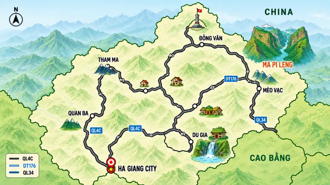
Stages and distances
| Stage (4-day Loop) | Approx. distance | Highlights |
|---|---|---|
| Ha Giang city to Yen Minh | About 96 km | Bac Sum Pass, Quan Ba Heaven Gate, Twin Mountains |
| Yen Minh to Dong Van via Lung Cu | About 115 km | Tham Ma Pass, Hmong King’s Palace, Lung Cu Flag Tower |
| Dong Van to Meo Vac and Du Gia | About 90 km | Ma Pi Leng Pass, Nho Que River gorge |
| Du Gia to Ha Giang city | About 74 km | Du Gia waterfall, valleys back to the city |
How the Loop is split into days
How you split the Loop decides how long you ride each day and how much time you have to stop. Below is the 4-day version, our favourite pace. Shorter tours combine stages; ask us for your exact itinerary.
Shorter tours
On a 2- or 3-day tour, the stages below are combined. You see the main passes and viewpoints, but the days are longer on the bike.
- 2 days: For travellers who are short of time. Long riding days with fewer stops.
- 3 days: A good balance for most people, covering the main highlights.
- Our advice: If you can, take 4 days. You will see more and spend less time watching the road.
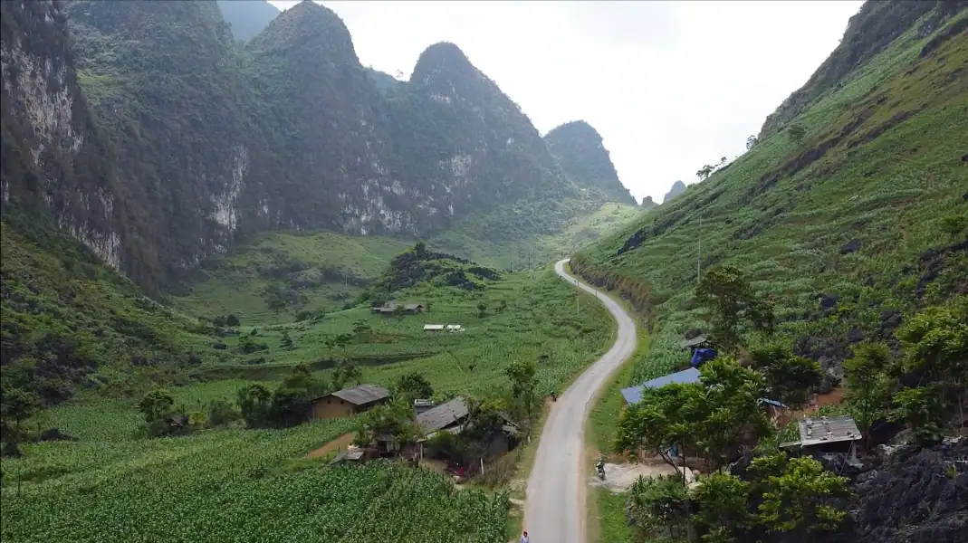
The 4-day Loop (about 375 km)
This is the pace we recommend, with time for villages, viewpoints and a swim at Du Gia.
- Day 1: Ha Giang city to Yen Minh (about 96 km): climb Bac Sum Pass, stop at Heaven Gate in Quan Ba, pass the Twin Mountains and ride through pine forest to Yen Minh.
- Day 2: Yen Minh to Dong Van via Lung Cu (about 115 km): cross Tham Ma Pass, visit the Hmong King’s Palace, detour to the Lung Cu Flag Tower in the far north and sleep in Dong Van.
- Day 3: Dong Van to Meo Vac and Du Gia (about 90 km): cross the Ma Pi Leng Pass, then descend to Du Gia.
Day 4 and practical notes
On this route, overnight stops are Yen Minh, Dong Van and Du Gia.
- Day 4: Du Gia to Ha Giang city (about 74 km): swim at Du Gia waterfall in the morning, then ride back through the valleys to Ha Giang city by mid-afternoon.
- Optional: Before or after the Loop, rest at TVPalm Ecolodge near Khuoi My, about 10 km from the city centre.
- Note: Distances are approximate and depend on detours and road works.
- Daylight: We plan each day to arrive before dark.
A good Loop is not about the distance. It is about having the time to stop where the road gives you something worth stopping for.
Key places on the map
These are the places most people want to see. Exact distances depend on your route and detours.
Bac Sum Pass and Quan Ba Heaven Gate
The climb into the mountains starts north of Ha Giang city on National Road 4C.
- Bac Sum Pass: A long climb of hairpin bends out of the valley, the first big climb of the Loop.
- Quan Ba Heaven Gate: A viewpoint over the Tam Son valley and the Twin Mountains.
Tham Ma Pass
Between Yen Minh and Dong Van.
- The road: A famous series of hairpin bends climbing a limestone slope, best seen from the viewpoint at the top.
- Safety: Watch for trucks and other bikes on the bends, and stop only where it is safe to pull off the road.
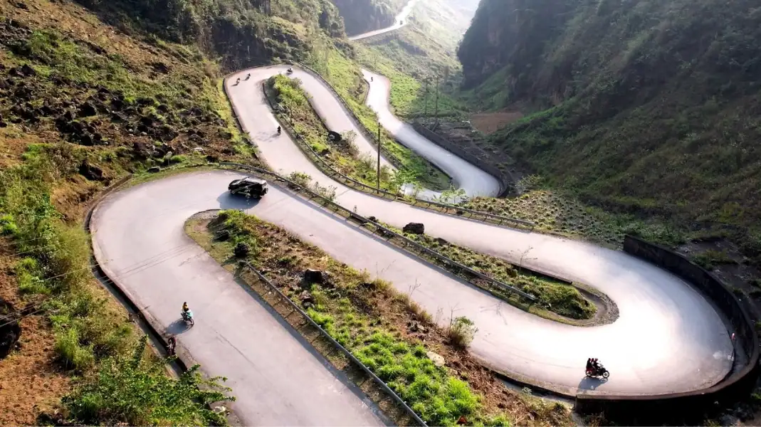
The Lung Cu detour
The northernmost point most travellers reach, close to the border with China.
- The road: A side road from National Road 4C leads north to the Lung Cu Flag Tower.
- Border permit: Lung Cu is in the border area. Carry your passport and make sure your permit is arranged.
Ma Pi Leng Pass
The most famous pass in Vietnam, between Dong Van and Meo Vac.
- The road: About 20 km of road cut into the cliffs high above the Nho Que River gorge.
- On foot: There are viewpoints and a walking path on the pass. Stay on safe ground; read our Ma Pi Leng guide.
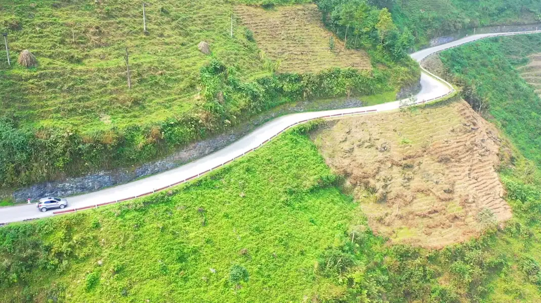
Navigation tips
Mountains and border areas make phone navigation less reliable. A few simple habits help:
- Download offline maps: Mobile signal drops in the deep valleys. Download the area on your map app before you leave.
- Follow the road signs: Look for the road numbers and the names of the next towns on signs and milestones.
- Avoid riding at night: Mountain passes have little lighting, and fog can come down in the late afternoon.
Carry a paper map or a printed itinerary as a backup, especially in remote border areas.
Before you leave: checklist
- Download offline maps of the Ha Giang area
- Save your overnight stops on your map
- Check with your easy rider that the bike is fuelled before long stages
- Keep a printed itinerary in your waterproof daypack
- Plan to start each day after breakfast and arrive before dark
- Save the TVPalm hotline (+84 366 885 955) in your phone
Frequently asked questions
Which direction is better: clockwise or anticlockwise?
The Loop can be ridden either way; each direction changes when the big views come. Our 4-day route goes anticlockwise: Ha Giang city, Yen Minh, Dong Van, Meo Vac, Du Gia and back. See our guide to where to start the Loop.
Can I trust Google Maps for travel times?
Not fully. On the Loop, bends, climbs, traffic and photo stops make every stage slower than the app suggests. Plan generous time.
What is the hardest section?
The high passes and the mountain roads in the south of the Loop, around Du Gia, can be steep and rough, and are worse after rain. That is one reason we ride with experienced local easy riders. Read more in our Loop motorbike guide.
Written by Nguyễn Văn Trung, founder of TVPalm. He has led small-group trips across Northeast Vietnam since 2021.


