

The Ha Giang Loop is a legendary 350 km to 400 km circular motorbike route in far-northern Vietnam that typically starts and ends in Ha Giang City, winding through the limestone peaks and ethnic villages of Quản Bạ, Yên Minh, Đồng Văn, and Mèo Vạc along National Highway 4C (the Happiness Road)
The Core Ha Giang Loop Map Overview
The official Ha Giang Loop map is a circular loop route starting and ending in Ha Giang City, primarily following National Highway QL4C and returning via Provincial Road DT176 and National Highway QL34.
The circuit covers approximately 300 to 380 kilometers depending on whether you take the express route or add detours to Lung Cu and Du Gia.
The terrain features elevation changes from 100 meters to over 1,400 meters, crossing the steep mountain passes of Quan Ba, Tham Ma, and Ma Pi Leng.
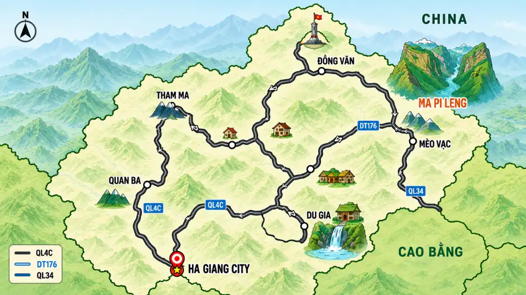
Distance and Travel Time Reference Table
| Journey Stage | Primary Highway / Road | Distance (km) | Driving Time (Estimated) | Landmark Highlights |
|---|---|---|---|---|
| Ha Giang City to Yen Minh | QL4C (National Highway) | 100 km | 3.5 – 4.5 hours | Bac Sum Pass, Heaven Gate, Twin Mountains |
| Yen Minh to Dong Van | QL4C / Lung Cu Detour | 50 – 80 km | 2.5 – 4 hours | Tham Ma Pass, Vuong Palace, Flag Tower |
| Dong Van to Meo Vac | QL4C (Ma Pi Leng Pass) | 25 km | 1 – 1.5 hours | Ma Pi Leng Skywalk, Nho Que River |
| Meo Vac to Du Gia | DT176 (Provincial Road) | 75 km | 3.5 – 4.5 hours | Lung Ho Pass, Du Gia Waterfall |
| Du Gia to Ha Giang City | DT176 / QL34 / QL2 | 100 km | 4 – 5 hours | Minh Son Pass, Khuoi My Village base |
Day-by-Day Route Map Layouts of Ha Giang Loop Map
Your choice of itinerary determines your daily driving route, stopovers, and total mileage. We organize our official TVPalm Adventure tours into three standard route formats.
1. The 2-Day Express Route Map (~300 km)
This fast-paced route is designed for experienced riders with limited schedules, focusing only on the primary karst plateau passes.
- Day 1 Route: Ha Giang City → Bac Sum Pass → Quan Ba Heaven Gate → Yen Minh Town → Tham Ma Pass → Dong Van Old Quarter (150 km / 5–6 hours riding time).
- Day 2 Route: Dong Van → Ma Pi Leng Pass → Meo Vac Town → QL34 Junction → Ha Giang City (150 km / 5–6 hours riding time).
- Map Note: This format skips the Du Gia Valley detour (DT176) to return quickly via QL34.
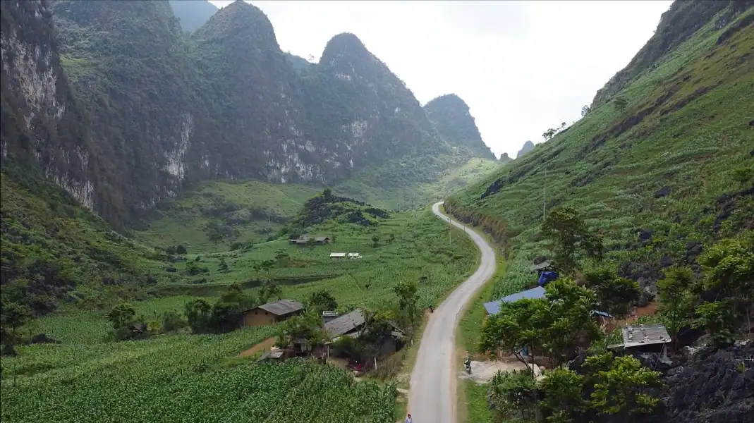
2. The 3-Day Classic Route Map (~350 km)
The standard loop itinerary covering all major geographical highlights at a manageable pace.
- Day 1 Route: Ha Giang City → Bac Sum Pass → Quan Ba Twin Mountains → Yen Minh Town (100 km / 4 hours).
- Day 2 Route: Yen Minh → Tham Ma Pass → Vuong Palace → Lung Cu Flag Tower → Dong Van Old Quarter (90 km / 4.5 hours).
- Day 3 Route: Dong Van → Ma Pi Leng Pass → Meo Vac → DT176 Road → Du Gia Village → Ha Giang City (160 km / 6 hours).
3. The 4-Day Immersive Route Map (~380 km)
Our highly recommended route. The slower pace allows for off-grid Hmong village visits, waterfall swimming, and deep cultural immersion.
- Day 1 Route: Ha Giang City → Thon Tha Village → Bac Sum Pass → Heaven Gate → Yen Minh Town (100 km / 4 hours).
- Day 2 Route: Yen Minh → Pho Cao Pass → Lao Xa Hmong Village → Dong Van Old Quarter (65 km / 3.5 hours).
- Day 3 Route: Dong Van → Lung Cu Flag Tower → Ma Pi Leng Pass → Nho Que River Boat Cruise → Meo Vac Town (65 km / 3.5 hours).
- Day 4 Route: Meo Vac → Lung Ho Pass → Du Gia Waterfall → Khuoi My Forest Base → TVPalm Ecolodge (150 km / 6 hours).
“At TVPalm Adventure, we strictly enforce a maximum 8-guest limit on our 4-Day Immersive Loop routes to ensure the convoy can safely navigate the narrow, unpaved village roads in Lao Xa and Khuoi My.”
Key Landmark Milestones on the Loop Map
Knowing the exact kilometer markers helps you plan rest stops and fuel refills.
Bac Sum Pass and Quan Ba Heaven Gate (km 30 to km 45)
The climb begins 30 kilometers north of Ha Giang City on highway QL4C.
- Bac Sum Pass: A steep 15-kilometer stretch of hairpin turns climbing to 800 meters elevation.
- Quan Ba Heaven Gate: Located at km 45. Features a viewing platform overlooking the Tam Son Valley and the Twin Mountains.
Tham Ma Pass (km 95)
Located 5 kilometers before the Yen Minh valley exit.
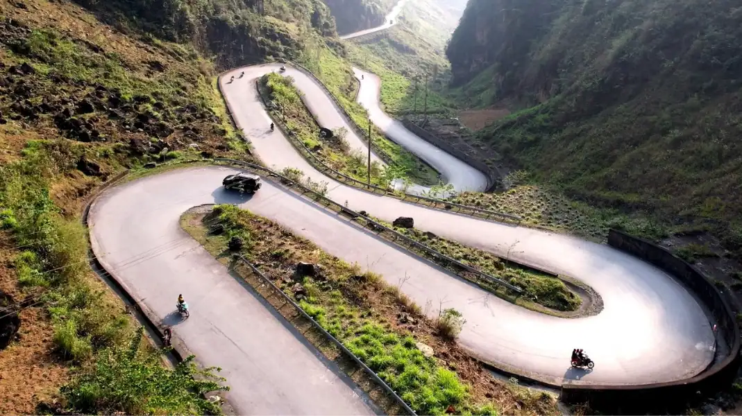
- The Route: A classic S-curve pass featuring nine consecutive hairpin bends climbing a steep limestone wall.
- Safety Note: Keep a steady throttle and watch for oncoming local trucks descending the pass.
Lung Cu Flag Tower Detour (km 130 to km 160)
The northernmost point of the loop, right on the border with China.
- The Route: Diverges north from QL4C at the Sa Phin junction (km 125). A winding 25-kilometer road leading to the tower.
- Border Permit: You must show your passport and border permit at the Lung Cu checkpoint before climbing the tower stairs.
Ma Pi Leng Pass (km 170 to km 185)
The most famous pass in Vietnam, connecting Dong Van and Meo Vac.
- The Route: A 20-kilometer road carved into a sheer limestone cliff, hanging 1,200 meters above the Nho Que River gorge.
- Skywalk Trail: A narrow walking path starting near the Ma Pi Leng Museum, offering unprotected views of the canyon.
Navigation and Google Maps Protocols for Ha Giang
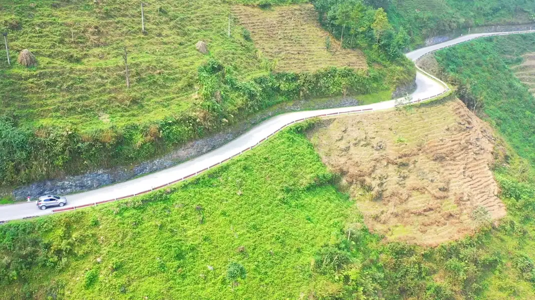
Mountain geography and border proximity make standard mobile navigation unreliable. Use these rules to prevent getting lost.
- Download Offline Maps: Mobile data signals drop in the deep canyons of Ma Pi Leng and Lung Ho. Download the entire Ha Giang Province map on Google Maps or Maps.me before departing Ha Giang City.
- Follow the Road Signs: The loop is well-signed. Look for the white concrete milestone posts marking highway numbers (QL4C, DT176, QL34) and remaining kilometers to the next town.
- Avoid Night Riding: Mountain passes lack road lighting, reflective markers, or crash barriers. Fog rolls in after 4:30 PM, reducing visibility to less than 5 meters. Plan your day to arrive at your overnight stop by 4:00 PM.
Official travel advisories from the Vietnam National Authority of Tourism remind visitors to carry physical maps when traveling in remote border zones of Northern Vietnam, as digital GPS coordinates can be inaccurate near the international boundary.
Pre-Departure Route Preparation Checklist
- Download offline Google Maps for Ha Giang Province
- Pin your overnight homestay locations and main fuel stations on your map
- Verify your motorbike has a full tank of fuel before leaving Ha Giang City and Dong Van
- Pack a physical paper map of the loop inside your waterproof daypack
- Set your daily departure time for 7:30 AM to avoid afternoon fog on high passes
- Add the emergency contact number of TVPalm Ecolodge (+84 366 885 955) to your phone
Frequently Asked Questions (FAQ)
Which direction is better to ride the Ha Giang Loop: clockwise or counter-clockwise?
We recommend riding the loop in the counter-clockwise direction (Ha Giang → Yen Minh → Dong Van → Meo Vac → Du Gia → Ha Giang). This direction allows you to tackle the Bac Sum and Tham Ma passes uphill, which is safer for control and gear shifting. It also places the spectacular Ma Pi Leng Pass on the afternoon of your second or third day, when the lighting is best for photography.
Can I rely on Google Maps for driving times on the loop?
No. Google Maps calculates driving times based on standard highway speeds of 50 to 60 km/h. On the Ha Giang Loop, the winding roads, steep gradients, local traffic, and frequent photo stops reduce your average speed to 25 to 30 km/h. A 100-kilometer stretch that Google Maps estimates will take 2 hours actually takes 4 to 5 hours of riding.
What is the most dangerous section of the loop map?
The DT176 road between Meo Vac and Du Gia (Lung Ho Pass) is the most challenging section. It features steep gravel switchbacks and is prone to mudslides after rain. The road is narrow and lacks safety barriers along many cliff sections. First-time riders should navigate this stretch with extreme caution or hire an Easy Rider guide.
Written by Văn Trung Nguyễn, Lead Expedition Director & Route Cartographer at TVPalm Adventure, Ha Giang. Mapping mountain routes since 2021.


