

The Ha Giang Loop is a circular route of roughly 350 to 400 km through the Dong Van Karst Plateau UNESCO Global Geopark and the mountains around it, in Ha Giang (part of Tuyen Quang province since July 2025).
It starts in Ha Giang city and follows National Road 4C north through Quan Ba, Yen Minh, Dong Van and Meo Vac, then returns south through Du Gia and the valleys back to the city.
The route and its roads
The road climbs from Ha Giang city, at about 200 m, onto the karst plateau at around 1,000 m and above, crossing several high passes.
── 46 km ──▶
Quan Ba
── 50 km ──▶
Yen Minh
── 45 km ──▶
Dong Van
── 22 km ──▶
Meo Vac
── 48 km ──▶
Du Gia
── 74 km ──▶
Ha Giang City
The Loop can be ridden either way. Our 4-day route goes anticlockwise: north on National Road 4C first, then back through Du Gia.
- National Road 4C: The main road north, from Ha Giang city through Quan Ba, Yen Minh and Dong Van to Meo Vac, over Bac Sum, Quan Ba, Tham Ma and Ma Pi Leng passes.
- The southern mountain road: From Meo Vac down to Du Gia: narrower and rougher in places, especially after rain.
- The way back: From Du Gia through the valleys back to Ha Giang city.
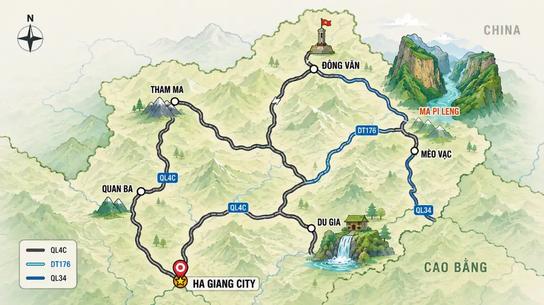
For a map of the route and the stages, see our Ha Giang Loop map guide.
The most common mistake is to underestimate riding time. In the mountains, bends, climbs, trucks and photo stops make every stage longer than it looks. Plan to arrive before dark.
3, 4 or more days?
The number of days decides how long you ride each day and how much time you have for the side trips, like Lung Cu, Du Gia or a village walk.
| Length | Pace | Good for | From |
|---|---|---|---|
| 2 days / 1 night | Long days on the bike, few stops | Travellers short of time | $225 per person |
| 3 days / 2 nights | Main highlights at a steady pace | Most travellers | $319 per person |
| 4 days / 3 nights | Comfortable, with Lung Cu and Du Gia | Our recommendation | $359 per person |
Our recommended 4-day Loop
Four days and three nights give you a comfortable pace, with time for villages, viewpoints and the canyon.
Day 1: Ha Giang City ──(46 km)──> Quan Ba ──(50 km)──> Yen Minh (96 km total)
Day 2: Yen Minh ──(25 km)──> Tham Ma ──(35 km)──> Lung Cu ──(30 km)──> Dong Van (90 km total)
Day 3: Dong Van ──(22 km)──> Ma Pi Leng ──(20 km)──> Mau Due ──(48 km)──> Du Gia (90 km total)
Day 4: Du Gia ──(74 km)──> Ha Giang City (74 km total)
Day 1: Ha Giang city to Yen Minh (about 96 km)
- Route: Ha Giang city, Bac Sum Pass, Quan Ba Heaven Gate, Tam Son, the pine forest, Yen Minh.
- On the road: Most of the day, with plenty of stops.
- Landscape: The first big climb out of the valley to Quan Ba, then down through pine forest to Yen Minh.
- Stops: Bac Sum Pass, Quan Ba Heaven Gate, the Twin Mountains, the pine forest of Yen Minh.
- Night: Homestay or hotel in Yen Minh.
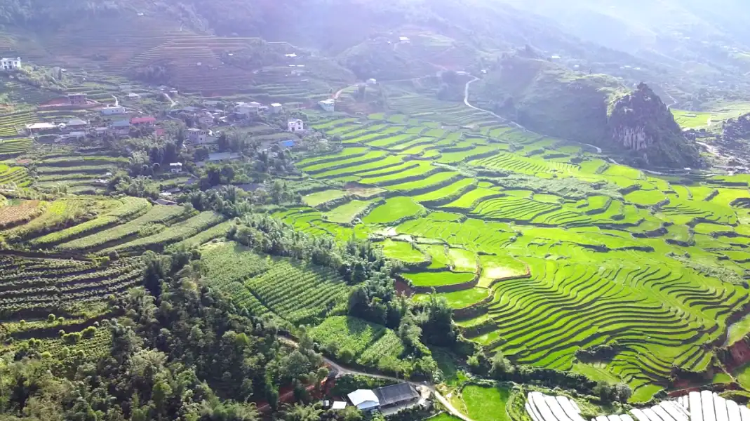
Day 2: Yen Minh to Dong Van via Lung Cu (about 115 km)
- Route: Yen Minh, Tham Ma Pass, Sa Phin, Lung Cu, Dong Van.
- On the road: A full day, with the Lung Cu detour.
- Landscape: Onto the high karst plateau, among grey stone and Hmong villages.
- Stops: Tham Ma Pass, the Hmong King’s Palace, the Lung Cu Flag Tower near the Chinese border, Dong Van old quarter.
- Night: Homestay or hotel in Dong Van.
Day 3: Dong Van to Du Gia via Ma Pi Leng (about 90 km)
- Route: Dong Van, Ma Pi Leng Pass, Meo Vac, the mountain road south to Du Gia.
- On the road: Most of the day; the road south is slower.
- Landscape: Ma Pi Leng above the Nho Que River gorge, then down to the green valley of Du Gia.
- Stops: Ma Pi Leng viewpoints, the walking path on the pass if conditions are safe, an optional boat trip on the Nho Que River.
- Night: Homestay in Du Gia, often in a Tay stilt house.
Day 4: Du Gia to Ha Giang city (about 74 km)
- Route: Du Gia, then through the valleys back to Ha Giang city.
- On the road: About half a day.
- Landscape: Down from Du Gia through river valleys to the city.
- Stops: A morning swim at Du Gia waterfall, village views on the way.
- Arrival: Back in Ha Giang city by mid-afternoon, in time for an evening bus to Hanoi.
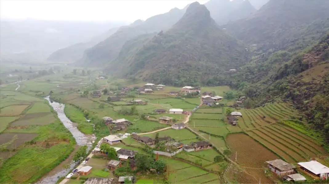
The main passes
The Loop’s main passes each have their own character. The table below gives a quick overview.
| Pass | Where | What it is like |
|---|---|---|
| Bac Sum | Between Ha Giang city and Quan Ba | The first long climb of hairpin bends out of the valley |
| Quan Ba (Heaven Gate) | Quan Ba | Viewpoint over the Tam Son valley and the Twin Mountains |
| Tham Ma | Between Yen Minh and Dong Van | Famous zigzag bends on a limestone slope |
| Ma Pi Leng | Between Dong Van and Meo Vac | Road cut into the cliffs above the Nho Que River gorge |
| Southern mountain road | Meo Vac to Du Gia | Narrower and rougher in places, slower after rain |
If you are deciding between a motorbike and a car, read our comparison of the Ha Giang Loop by car or motorbike.
Roads and vehicles
Most of the Loop is paved, but mountain roads need experience, especially in rain.
- Motorbike: TVPalm easy riders use well-maintained motorbikes suited to mountain roads. You ride as a passenger.
- Car: For private car tours, we use vehicles suited to narrow mountain roads, with experienced local drivers.
- Fuel: There are fuel stations in the main towns, such as Ha Giang city, Yen Minh, Dong Van and Meo Vac. Your rider or driver plans the stops.
For fuel, coffee and rest stops along the way, see our Ha Giang Loop rest stops guide.
Safety checklist
Before you leave Ha Giang city:
- Permits and documents: Carry your passport. TVPalm arranges your border area permit (260,000 VND per guest, about $10). No licence is needed for passengers.
- Vehicle check: Your rider checks the brakes, tyres and chain before departure.
- Luggage: Bring a soft backpack of 10 to 15 kg. Your rider straps it securely to the bike.
- Daily timing: Plan to arrive before dark; mountain roads are not lit.
- Rain gear: A two-piece rain suit and dry bags for your electronics. Mountain weather changes fast.
FAQ
Which direction is best?
Both directions work; each changes when the big views come. Our 4-day route goes anticlockwise: Ha Giang city, Quan Ba, Yen Minh, Dong Van, Meo Vac, Du Gia and back.
Are 3 days enough?
Three days cover the main Loop, but the days on the bike are longer and you have less time to stop. If you can, take four.
Do I need a guide?
TVPalm runs easy rider tours only, because steep passes, rough sections, the language and the border permit are much easier with an experienced local rider. Your rider handles the road, the bike and the stops.
Written by Nguyễn Văn Trung, founder of TVPalm. Specializing in mountain road journeys, easy rider tours and ecolodge stays in Northeast Vietnam.


