

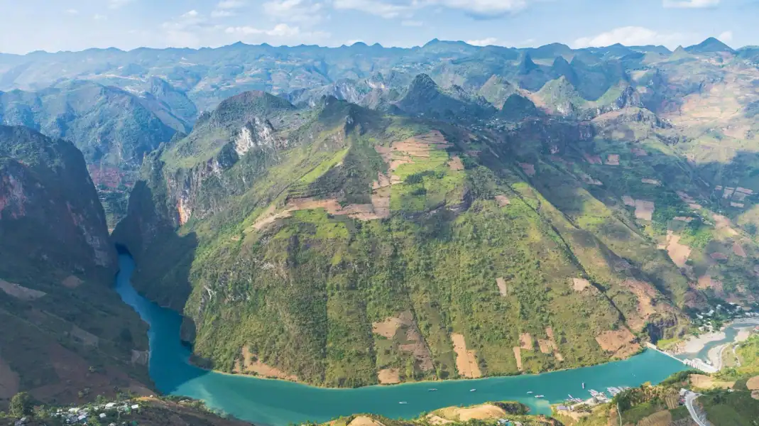
Tay Con Linh, at 2,428 m, is the highest peak in Northeast Vietnam. Far from the motorbike traffic of the Ha Giang Loop, a 3-day, 2-night trek takes you through primary forest, old moss-covered Shan Tuyet tea trees and the Dao Ao Dai villages on its slopes. Ha Giang has been part of Tuyen Quang province since July 2025.
This guide sets out the route day by day, the fitness you need, the border permit, and the gear to bring.
Why climb Northeast Vietnam’s highest peak
Forest well above the tourist trail
The Tay Con Linh forest covers a large area of subtropical and temperate mountain forest.
On the narrow ridge paths you walk through giant bamboo, wild cardamom gullies and fern valleys hung with orchids and moss. There is no road up here; you hear streams and birds.
Old Shan Tuyet tea trees
Higher up, the trail passes through groves of old Shan Tuyet tea trees, a rare sight even in Vietnam.
Many of these trees are hundreds of years old, with thick, moss-covered trunks in almost constant cloud. Picking the silvery, downy buds is a skill Dao families have passed down for generations.
The Dao Ao Dai of Xa Phin
In the misty valley below the summit is Xa Phin, known for its old palm-leaf roofs covered in thick green moss.
The Dao Ao Dai here still farm, wear hand-embroidered indigo clothes and use herbal remedies. An evening by their fire, eating what the family grows, is the part many guests remember most.
The 3-day, 2-night route, day by day
Day 1: arrive and rest at TVPalm Ecolodge
- In short: no walking, arrival in the early afternoon, a swim and an early night.
- The day: arrive at TVPalm Ecolodge in the early afternoon, check in to a private room, swim in the mountain-spring pool, watch the sunset and go to bed early.
Day 2: through the Dao Ao Dai villages to Xa Phin (920 m)
- In short: about 12.5 km, 5 to 6 hours of walking.
- The day: leave TVPalm Ecolodge on foot through the Dao Ao Dai villages of Khuoi My and Lung Vai on the eastern slopes, then round to Na Mau and Xa Phin on the north-western side of the mountain, past terraced fields, palm forest and streams. Lunch with a family. Dinner and night in a Dao Ao Dai stilt-house homestay with a moss-covered roof in Xa Phin.

Day 3: the ranger hut, the 2,428 m summit, and back
- In short: about 14.5 km, about 600 m of climbing, 2.5 to 3 hours to the top.
- Route Description: Leave the Xa Phin homestay at 06:00 and ride with an Easy Rider (about 1.5 hours) to the Forest Ranger hut at 1,800 m. It is a short stop only: you cannot stay or camp there. Climb about 600 m through primary rainforest to the 2,428-meter granite peak, eat lunch at the top, then descend and ride back to Ha Giang City, the bus station or TVPalm Ecolodge.
The route in figures
| Day & Segment | Distance | Elevation Change | Terrain & Vegetation | Night Stay |
|---|---|---|---|---|
| Day 1: Arrival at TVPalm Ecolodge | No walking | – | Ecolodge and valley views | TVPalm Ecolodge (private room) |
| Day 2: TVPalm to Xa Phin | About 12.5 km (5 – 6 hrs) | Up to 920m | Terraced paddies, bamboo groves, Dao villages | Xa Phin Moss-Roofed Homestay |
| Day 3: Summit & Return | About 14.5 km (2.5 – 3 hrs of climbing) | About 600m climb from 1,800m | Primary rainforest, 2,428m granite peak | TVPalm Ecolodge or Ha Giang City |
Fitness, logistics and the border permit
Fitness: training for the climb
Walking about 12.5 km and then climbing about 600 m on narrow, uneven paths needs good fitness and strong legs. Some hiking on steep ground before the trip, and regular stair climbing or trail running for 4 to 6 weeks before, will help a lot.
The border permit
Tay Con Linh is in the northern border area, so foreigners need a Border Area Entry Permit (260,000 VND, about $10 per guest). TVPalm arranges it before your trek.

When to go
The best season is October to April: cool, dry air (12°C to 20°C), little rain, and the best chance of a sea of clouds from the summit.
Gear and safety checklist for Tay Con Linh
- Trekking shoes with grip: sturdy boots with deep Vibram or Contagrip lugs for slippery clay and wet roots.
- Trekking poles: for balance, and to spare your knees on the long way down.
- Layers and a rain jacket: a quick-dry base layer, a fleece, and a light windproof and waterproof jacket.
- Dry bags: to keep spare clothes, passport and electronics dry.
- Headlamp and spare batteries: for the early start on day 3.
The 3-day Tay Con Linh trek: common questions
Can I trek Tay Con Linh without a guide?
We strongly advise against it. The trails are unmarked, the forest blocks GPS, and the area is near the border. Walk with a trek leader and local Dao porters.
Where do I sleep on the 3-day trek?
Night 1 in a private room at TVPalm Ecolodge. Night 2 in a Dao Ao Dai homestay with a moss-covered roof in Xa Phin (920 m), with hot water and warm blankets. The forest ranger hut at 1,800 m is a short stop only, not a place to sleep.
How do I get from Hanoi to the start?
Take a night sleeper bus or a daytime limousine van from Hanoi to Ha Giang City (about 5.5 to 6 hours). From the bus station, take a taxi to TVPalm Ecolodge, about 10 km away. We are happy to call one for you.
Written by Nguyễn Văn Trung, founder of TVPalm. He has led small-group trips across Northeast Vietnam since 2021.


