

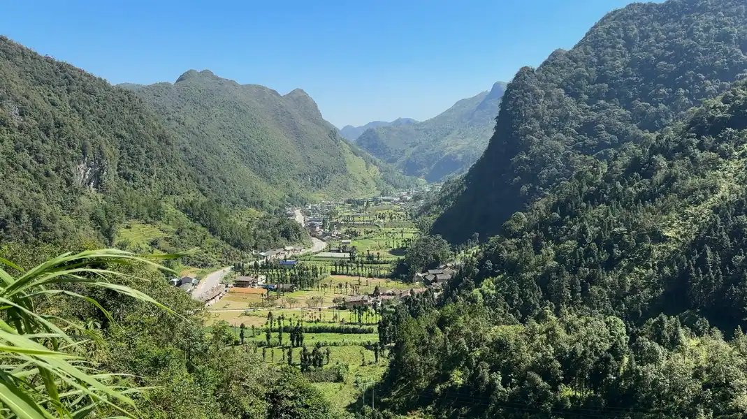
Tay Con Linh, at 2,428 m, is the highest peak in Northeast Vietnam. It rises between Vi Xuyen and Hoang Su Phi in Ha Giang (part of Tuyen Quang province since July 2025), above Dao Ao Dai villages, old Shan Tuyet tea trees and primary forest. This is our home mountain, and this guide sets out how we trek it, day by day.
Your options at a glance
The right choice depends on your fitness, how many days you have, and whether you want to reach the summit.
| Option | Walking | Climbing | Nights | Who it suits |
|---|---|---|---|---|
| 3 days, 2 nights (summit trek) | About 12.5 km on day 2 and about 14.5 km on day 3 | About 600 m from the ranger hut (1,800 m) to the summit | 1 night at TVPalm Ecolodge, 1 night in a Dao Ao Dai stilt-house homestay in Xa Phin (920 m) | Fit walkers who want the summit |
| 2 days, 1 night (summit trek, no rest day) | About 12.5 km on day 1 and about 14.5 km on day 2 | About 600 m from the ranger hut (1,800 m) to the summit | 1 night in a Dao Ao Dai stilt-house homestay in Xa Phin (920 m) | Fit walkers who are short on time |
| 1 day (Na Thac village walk) | About 3.25 km | Gentle | Back to TVPalm Ecolodge | Families and anyone who wants a short taste of the mountain |
“Tay Con Linh rewards preparation. We also run a 2-day version of the same walk, but we recommend the 3-day trek because it gives you a night of rest before the long days, time in the villages, and a better chance of reaching the summit fresh.”
Nguyễn Văn Trung, Founder, TVPalm
The 3-day, 2-night summit trek, day by day
The 3-day route starts and ends at TVPalm Ecolodge, near Khuoi My, about 10 km from the centre of Ha Giang city. It crosses Dao Ao Dai villages, terraced fields and forest, then climbs to the summit ridge.
Day 1: arrive and rest at TVPalm Ecolodge
- Early afternoon: arrival. Check in to a private room and rest after the journey.
- Afternoon: swim and relax. Swim in the mountain-spring pool and settle in.
- Sunset. Enjoy the evening light over the valley.
- Evening: briefing and dinner. Meet your guide, check your gear and share a farm-to-table dinner.
- Night. Go to bed early before the walk to Xa Phin.
Day 2: through the Dao Ao Dai villages to Xa Phin (about 12.5 km)
- Morning: set off on foot. Leave TVPalm Ecolodge and walk through the Dao Ao Dai villages of Khuoi My and Lung Vai, on the eastern slopes, past terraced fields, palm forest and streams.
- Midday: lunch with a family. Share a home-cooked lunch along the way.
- Afternoon: round to Na Mau and Xa Phin, on the north-western side of the mountain. In all, about 5 to 6 hours of walking.
- Evening: Xa Phin (920 m). Dinner and a night in a Dao Ao Dai stilt-house homestay with a moss-covered roof.
Day 3: the ranger hut, the 2,428 m summit, and back (about 14.5 km)
- 06:00: easy rider transfer. Leave the Xa Phin homestay and ride about 1.5 hours to the Forest Ranger hut at 1,800 m. It is a short stop only: you cannot stay or camp there.
- Morning: the summit climb. Climb about 600 m through primary forest and dwarf bamboo to the 2,428 m summit, about 2.5 to 3 hours.
- Midday: lunch at the top. On a clear day, the views stretch across the mountains of Ha Giang.
- Afternoon: down and back. Walk down carefully, then ride back to Ha Giang city, the bus station or TVPalm Ecolodge.
| Day | Route | Distance and time | Height | Night |
|---|---|---|---|---|
| Day 1 | Arrival and rest at TVPalm Ecolodge | No walking | – | TVPalm Ecolodge (private room) |
| Day 2 | TVPalm Ecolodge → Khuoi My → Lung Vai → Na Mau → Xa Phin | About 12.5 km, 5 to 6 hours | Villages and terraced fields, up to 920 m | Dao Ao Dai stilt-house homestay, Xa Phin |
| Day 3 | Xa Phin → easy rider → ranger hut (1,800 m) → summit (2,428 m) → back | About 14.5 km; 2.5 to 3 hours of climbing | About 600 m of climbing from 1,800 m | TVPalm Ecolodge or Ha Giang city |
The best seasons
Weather on Tay Con Linh changes fast. Choosing the right season gives you a better chance of dry trails and clear views.
| Season | What to expect | For trekking |
|---|---|---|
| Autumn (October – November) | Generally dry, clear days, rice harvest in the valleys | Our favourite time |
| Winter (December – February) | Cold, especially at the top; sometimes seas of cloud | Good, with warm layers |
| Spring (March – April) | Mild; rhododendrons and new tea leaves | Good |
| Summer (May – September) | Hot and humid in the valleys, frequent rain, muddy trails | The most demanding season |
What to bring and the border permit
Steep, often wet forest trails call for good footwear, warm layers and a border permit.
- Trekking boots: sturdy, broken-in boots with a good grip, ideally waterproof.
- Trekking poles: they help a lot on the steep descent.
- Layers: a base layer, a fleece and a warm jacket for the cold summit morning.
- Rain jacket: showers can come at any time of year.
- Headlamp: for the early start on day 3.
- Daypack: 20 to 30 litres, with water and dry bags for your phone and camera.
- Border permit: Tay Con Linh is in a border area. TVPalm arranges the permit for you (260,000 VND, about 10 USD per guest).
Frequently asked questions
What is the starting and ending point for the Tay Con Linh trek?
The 3-day trek starts and ends at TVPalm Ecolodge, near Khuoi My, about 10 km from the centre of Ha Giang city.
Where do trekkers sleep during the 3-day itinerary?
Night 1 is in a private room at TVPalm Ecolodge. Night 2 is in a Dao Ao Dai stilt-house homestay in Xa Phin (920 m). The Forest Ranger hut at 1,800 m is a short stop only and cannot be used overnight.
What is the best month to trek Tay Con Linh?
October and November usually bring dry trails and clear views. December to February can be cold but beautiful, sometimes with seas of cloud. Spring is mild, with rhododendrons in bloom.
Written by Nguyễn Văn Trung, Founder of TVPalm, a specialist in mountain road travel, trekking and ecolodge stays in Northeast Vietnam.


