

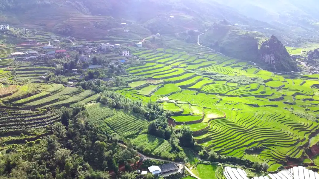
Understanding Ha Giang Loop weather is essential for planning a safe, scenic circuit across northern Vietnam’s mountain passes.
The regional climate varies dramatically between low-altitude river valleys (100 meters) and high karst plateaus (1,200+ meters), creating sharp temperature drops, sudden fog banks, and seasonal rainfall patterns.
September through November and March through May offer optimal conditions with dry roads, clear visibility, and comfortable temperatures between 18°C and 26°C. This field guide provides a month-by-month weather analysis, altitude microclimate data, road safety advisories, and seasonal packing lists for 2026 travelers.
When to ride the Ha Giang Loop?
The climate across Ha Giang Province falls into three distinct seasonal phases, each presenting unique riding conditions and landscape highlights.
- Dry asphalt & clear mountain visibility
- Mild temperatures: 18°C to 26°C
- Golden rice harvest (Sep-Oct) & spring blooms (Mar-Apr)
- Optimal for both self-drive & Easy Rider
- Cold pass temperatures: 5°C to 14°C
- Thick freezing fog on Quan Ba & Ma Pi Leng
- Low rain, but damp slick asphalt on bends
- Requires heavy thermal layers & slow speeds
- High heat (28°C-34°C) & heavy downpours
- Landslide risk on DT177 & DT176 dirt tracks
- Lush green mountain terraces & full waterfalls
- Easy Rider or 4WD car strongly recommended
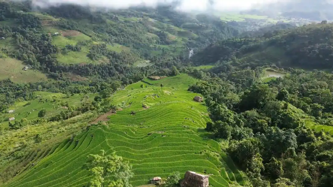
For first-time travelers choosing between transport options during different seasons, review our complete Ha Giang Loop Travel Guide for Beginners.
« Weather on Ma Pi Leng Pass can change in 15 minutes. You can start climbing from Yen Minh under clear blue skies, and by the time you reach 1,200 meters elevation, you are riding through thick fog with visibility under 20 meters. Checking local weather updates before leaving your morning homestay is essential for road safety. » – Văn Trung Nguyễn, TVPalm Adventure
Month-by-Month Ha Giang Loop weather table
| Month | Temp. Range (Plateau) | Avg. Rainfall | Road Conditions | Visibility | Highlight Scenery | Recommendation |
|---|---|---|---|---|---|---|
| January | 6°C – 14°C | 25 mm (Low) | Cold, damp, slick bends | Low to Moderate (Fog) | Peach blossoms, mist valleys | Good with warm gear |
| February | 8°C – 16°C | 30 mm (Low) | Cool, dry roads | Moderate | Spring blossoms, Tet festival | Good |
| March | 14°C – 22°C | 45 mm (Moderate) | Dry, clear asphalt | Excellent | Plum & mustard blossoms | Excellent |
| April | 18°C – 26°C | 60 mm (Moderate) | Dry, ideal traction | Excellent | Green fields, comfortable weather | Best Overall |
| May | 22°C – 30°C | 150 mm (High) | Warm, occasional storms | Good | Water-pouring season (terraces) | Good |
| June | 24°C – 32°C | 280 mm (Monsoon) | Heavy rain, mud on side tracks | Moderate | Vibrant green rice, full rivers | Caution (Landslide risk) |
| July | 24°C – 33°C | 310 mm (Monsoon) | Peak rainfall, landslide risk | Moderate | Lush waterfalls, full rivers | Extreme caution |
| August | 23°C – 31°C | 260 mm (Monsoon) | Tropical rain, river overflow | Moderate to Good | Ripening rice fields | Exercise caution |
| September | 20°C – 28°C | 120 mm (Moderate) | Drying roads, clear skies | Excellent | Golden rice harvest | Best Overall |
| October | 16°C – 24°C | 60 mm (Low) | Dry, crisp air | Excellent | Golden terraces & buckwheat | Best Overall |
| November | 12°C – 20°C | 35 mm (Low) | Dry, cool mountain air | Excellent | Buckwheat flower festival | Excellent |
| December | 8°C – 15°C | 25 mm (Low) | Cold, dry, foggy passes | Low to Moderate | Winter mist, mountain frost | Good with thermals |
Understanding altitude microclimates
A common mistake for first-time visitors is assuming the temperature in Ha Giang City applies across the entire loop.
- Ha Giang City (Elevation 100m): Warmest point on the circuit. Summer temperatures reach 32°C to 35°C, while winter averages 15°C to 18°C.
- Tam Son / Quan Ba (Elevation 800m): Temperatures drop by 4°C to 5°C compared to Ha Giang City. Morning fog is common around Heaven’s Gate.
- Dong Van & Meo Vac (Elevation 1,100m – 1,200m): Temperatures drop by 6°C to 9°C compared to Ha Giang City. Winter nights regularly fall below 5°C, with occasional frost on surrounding peaks.
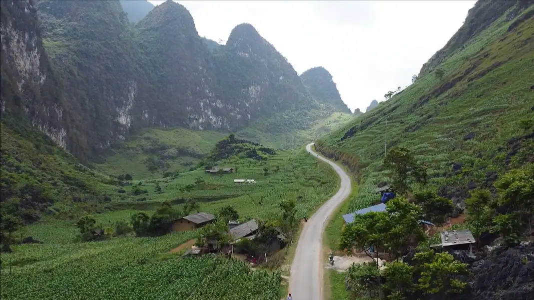
When planning your route across these varying elevations, refer to our complete Ha Giang Loop Route Guide.
Seasonal packing & Gear requirements
Packing the right apparel ensures safety and comfort regardless of the month you choose to ride.
Dry Season Gear (September to April)
- Thermal Base Layers: Long sleeve thermal tops and bottoms for cold mornings and high pass riding.
- Windproof Jacket: A fleece-lined, windproof riding jacket to block cold air on descents.
- Riding Gloves: Insulated full-finger gloves for winter months (Dec-Feb); breathable leather gloves for spring/autumn.
- Enclosed Footwear: High-ankle boots or sturdy sneakers to protect feet against cold wind and rough limestone.
- Sun & Dust Protection: UV-blocking sunglasses, neck gaiter/buff, and SPF 50 sunscreen for bright alpine sun.
Monsoon Season Gear (May to August)
- Waterproof Suit: High-quality 2-piece waterproof jacket and trousers (ponchos tear in mountain wind).
- Dry Bags: 20L to 30L heavy-duty PVC dry bags for all clothing, electronics, and passports.
- Waterproof Boot Covers: Rubber shoe covers to keep footwear dry during heavy tropical downpours.
- Anti-Fog Visor / Goggles: Clear helmet visor treated with anti-fog spray for riding in rain.
FAQ
What is the single best month to ride the Ha Giang Loop?
October is widely considered the single best month to ride the Ha Giang Loop. October offers crisp, dry weather with minimal rainfall, clear blue skies for pass photography, comfortable temperatures (16°C to 24°C), and the peak of the golden rice terrace harvest alongside early buckwheat flower blooms. April is a close second for clear spring weather and blooming mountain flora.
Is it safe to self-drive the Ha Giang Loop during monsoon season (June to August)?
Self-driving during monsoon season carries elevated risk for inexperienced mountain riders. Heavy downpours create slick mud slumping on unpaved roads like the DT176 (Mau Due to Du Gia) and increase the potential for flash landslides. If traveling between June and August, booking an Easy Rider guided tour or a private 4WD car tour is strongly recommended, as local drivers know how to navigate wet roads safely and adjust daily routes around weather hazards.
How cold does it get on the Ha Giang Loop in winter?
In winter (December through February), daytime temperatures in Ha Giang City hover around 15°C, but high-altitude towns like Dong Van (1,100m) drop to 5°C – 10°C during the day. Nighttime temperatures in high mountain homestays can drop below 3°C, with occasional frost on Ma Pi Leng Pass. Windchill on motorbikes makes it feel significantly colder, requiring thermal base layers, a fleece, a windproof jacket, and insulated gloves.
Written by Văn Trung Nguyễn, Lead Expedition Director & Licensed Tour Operator at TVPalm Adventure, Ha Giang. Specializing in mountain road expeditions, weather safety, and eco-tours in Northeast Vietnam.


