

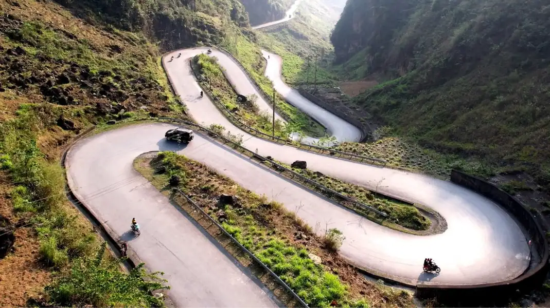
Roads in Ha Giang (part of Tuyen Quang province since July 2025) change a lot along the Loop. Some stretches are wide, smooth tarmac. Others are narrow mountain roads cut into cliffs, with tight bends and long drops. Knowing which is which helps you relax on the easy parts and stay careful on the hard ones.
The Loop at a glance
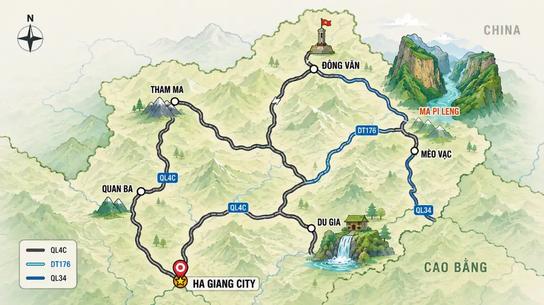
The Loop follows the main road north from Ha Giang city through Quan Ba and Yen Minh to Dong Van, crosses the Ma Pi Leng Pass to Meo Vac, then comes back south through Du Gia. Most of it is paved, but paved does not mean easy: the surface, width and traffic change from one valley to the next.
| Stage | Distance | Main passes | Road | How TVPalm travels it |
|---|---|---|---|---|
| Day 1: Ha Giang city to Yen Minh | About 96 km | Bac Sum Pass, Quan Ba Heaven Gate | Busy main road, mostly good tarmac | Easy rider on a manual motorbike, or car with driver |
| Day 2: Yen Minh to Dong Van via Lung Cu | About 115 km | Tham Ma Pass | Paved, narrow in places, colder plateau | Easy rider on a manual motorbike, or car with driver |
| Day 3: Dong Van to Meo Vac and Du Gia | About 90 km | Ma Pi Leng Pass | Cliff road, then quieter and rougher road to Du Gia | Experienced easy rider; car with driver possible |
| Day 4: Du Gia to Ha Giang city | About 74 km | Valley and forest roads | Mostly paved, rough patches after rain | Easy rider on a manual motorbike, or car with driver |
Most Loops cover about 350 to 400 km. We recommend four days, so there is time for villages, viewpoints and bad weather.
The road, section by section
Ha Giang city to Quan Ba: Bac Sum Pass
This is the gentlest start. The road leaves the valley, where the city sits at around 200 m, and climbs to the Quan Ba Heaven Gate. It is a busy, well-used road.
- Bac Sum Pass: the first big climb, with a long series of hairpin bends. The views back over the valley are worth a stop.
- Hazards: trucks and local buses use this road every day and swing wide on the bends. Keep to your side.
- Season: from late autumn to early spring, morning fog is common on the higher ground. On foggy mornings it is wise to start a little later.

Quan Ba to Yen Minh
After Quan Ba, the road runs past the Twin Mountains and through farming valleys and pine forest towards Yen Minh. The surface varies, with patched sections and occasional roadworks.
- Landscape: stone walls, maize fields and small Hmong and Tay villages close to the road.
- Hazards: buffalo, cattle, goats and children on the road, especially early and late in the day. Slow down near every village.
- Season: in the rainy season (roughly May to August), mud and small landslides can appear after heavy rain. Allow extra time.
Yen Minh to Dong Van: Tham Ma Pass
Between Yen Minh and Dong Van, the road climbs onto the Dong Van Karst Plateau. Most travellers also make the detour north to the Lung Cu Flag Tower.
- Tham Ma Pass: a famous series of tight switchbacks on the road between Yen Minh and Dong Van. It is paved but narrow in places.
- Surface: road conditions change with repairs and the weather. Ask your guide or locals about the latest situation rather than trusting old reports.
- Hazards: trucks on narrow bends, and travellers stopping suddenly to take photos. Never stop on a bend.
- Season: the plateau is higher and colder than the valleys. Bring warm layers, even in spring and autumn.
Dong Van to Meo Vac: the Ma Pi Leng Pass
This is the most impressive road in Ha Giang. For about 20 km, it is cut into the cliffs high above the Nho Que River and the Tu San Canyon, which is around 700 to 800 m deep.
- Width: narrow in places. When a car or truck comes the other way, it is often the motorbike that has to stop.
- Viewpoints: stop only at proper pull-offs and viewpoints, never on the road itself.
- Walking path: a path along the cliffs starts near the pass. It is exposed, so walk it only in dry weather.
- Hazards: the descent towards Meo Vac has many bends, and speed is the main danger. Ride slowly and brake gently and early.
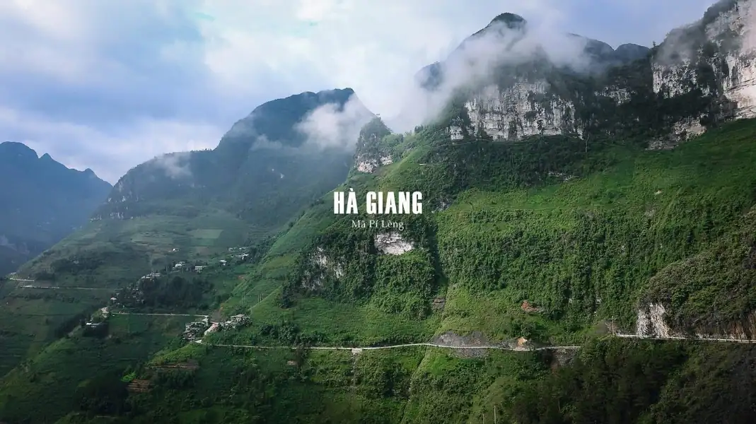
The Ma Pi Leng Pass is paved, but it leaves no room for mistakes. That is why TVPalm only runs it with experienced local easy riders, and why we never rent motorbikes for self-drive.
For the whole route with stages and distances, see our Ha Giang Loop map guide.
Meo Vac to Du Gia and back to Ha Giang city
South of Meo Vac, the road to Du Gia is quieter, narrower and rougher than the main road. It drops through mountains and forest to the Du Gia valley, then continues back to Ha Giang city.
- Surface: mostly paved, with broken or loose patches that get worse after rain.
- Rainy season: mud and landslides can slow you down. Keep your plans flexible and leave early.
- Landslides: after heavy rain, local people and road crews clear the road, but it can take time. Always check conditions before you leave Meo Vac.
- Hazards: livestock on the road and very few services between villages.
Which vehicle for which road
Here is how the main options compare on Ha Giang roads.
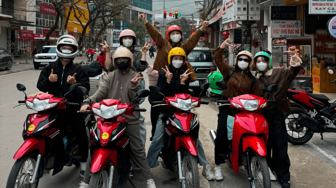
- Manual motorbike with an easy rider: the way most TVPalm guests travel the Loop. You sit behind an experienced local rider, who handles the bends, the brakes and the bike.
- Semi-automatic or manual motorbike, ridden by an experienced rider: suited to mountain roads, because the rider can use the engine to slow down on long descents.
- Automatic scooter: fine in town, but not a good choice for the long, steep descents of Tham Ma and Ma Pi Leng.
- Car with driver: the most comfortable option in fog, rain or cold, and a good choice for families and anyone who does not want to ride.
See the overview table for distances, main passes and road notes by stage.
If you are not confident on mountain roads, ride as a passenger with an easy rider. See our Ha Giang easy rider tours guide.
Safety checklist for the Loop
- Check the brakes, front and rear, before each riding day (your easy rider does this on TVPalm tours).
- Ride slowly on cliff sections and never overtake on a bend.
- Do not ride the Ma Pi Leng Pass in thick fog or heavy rain. Wait for the weather to clear.
- In the rainy season, ask your guide or locals about the road before taking the route to Du Gia.
- Sound your horn briefly before blind bends. It is normal local practice.
FAQ
Are Ha Giang roads suitable for automatic scooters?
Automatic scooters are common in Vietnamese towns, but long, steep descents like Tham Ma and Ma Pi Leng are hard on brakes. A manual motorbike, ridden by someone experienced, is better suited to these roads. On TVPalm tours you do not ride yourself: you sit behind an experienced easy rider.
How long does it take to ride from Ha Giang city to Dong Van?
It is possible in one long day, but we do not recommend it. On our 4-day Loop, the first day goes from Ha Giang city to Yen Minh (about 96 km), and the second from Yen Minh to Dong Van via Lung Cu (about 115 km). Mountain roads are slow, so plan to arrive before dark.
Is there a mobile phone signal on the Loop?
There is a signal in towns and on most of the main road, but there are gaps in the mountains. Download offline maps before you leave Ha Giang city and buy a local SIM card.
Written by Nguyễn Văn Trung, Founder of TVPalm, a specialist in mountain road travel, trekking and ecolodge stays in Northeast Vietnam.


