

Planning strategic Ha Giang Loop rest stops is vital for safe mountain travel across northern Vietnam. I am Nguyễn Văn Trung, founder of TVPalm, leading small-group trips across Northeast Vietnam. Navigating steep passes on two wheels demands physical endurance and situational awareness.
Our team maps every scenic viewpoint, roadside cafe, regional eatery, and petrol station across the 350-kilometer circuit to keep riders refreshed, hydrated, and fully prepared for changing weather.
Why strategic rest stops are essential on the Ha Giang Loop
Strategic rest stops along the Ha Giang Loop prevent physical exhaustion, maintain rider focus on steep switchbacks, and ensure dependable refueling before remote mountain stages.
The circuit climbs from 100 meters in Ha Giang City to elevations exceeding 1,500 meters across the Dong Van Karst Plateau, creating physical fatigue, engine strain, and sudden microclimate shifts.
Riding four to six hours daily across uneven limestone roads tires your lower back and neck muscles. Pillion passengers must maintain continuous balance through sharp hairpin corners, which drains stamina. Taking planned breaks every 45 to 60 minutes restores mental alertness and allows core muscles to relax.
Fuel stations remain clustered in major district towns, separated by long stretches of uninhabited passes. Running out of petrol along cliffside climbs creates severe safety hazards. Coordinated breaks align refueling with meals, while allowing clothing adjustments as warm valleys at 26 degrees Celsius give way to foggy passes at 12 degrees Celsius.
The most common mistake on mountain circuits is pushing forward without scheduled pauses. Fatigued riders react slowly to sudden obstacles, loose gravel, and oncoming trucks. We organize our itineraries around rhythmic breaks, ensuring every leg remains safe and memorable.
10 best rest stops and scenic viewpoints on the Ha Giang Loop
1. Km 0 Milestone in Ha Giang City
The Km 0 Milestone at Ha Giang City central square marks the official starting point of National Road 4C. Riders gather here early to photograph the landmark monument, verify tire pressure, and secure luggage before climbing northern passes. Nearby cafes offer coffee and morning noodle soups.
2. Quan Ba Heaven Gate and Co Tien Twin Mountains (Km 43)
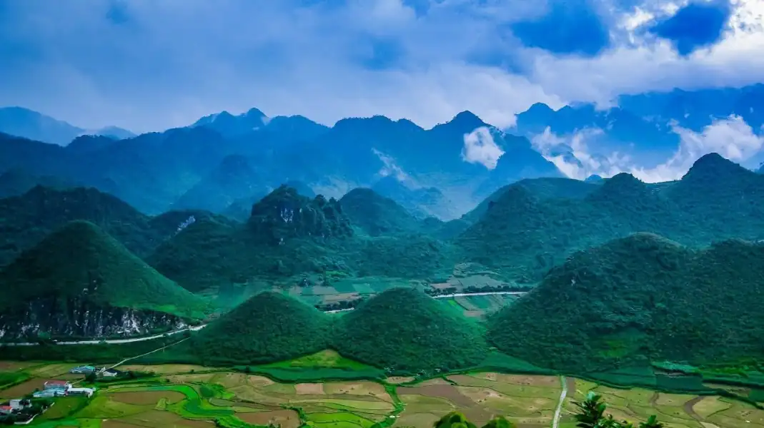
Quan Ba Heaven Gate (Cổng Trời Quản Bạ) rises over 1,000 meters above sea level as the gateway to the UNESCO Dong Van Karst Plateau Global Geopark. The viewing deck provides panoramic vistas across Tam Son Valley and the geological Co Tien Twin Mountains, complete with hot tea stalls.
3. Can Ty lonely tree and white stone cliff rest area
The Can Ty pass features an iconic solitary tree clinging to vertical limestone cliffs above the river valley. Away from heavy commercial trucks, this peaceful rest area offers shaded bamboo drink shacks, scenic photographic viewpoints, and fresh sugarcane juice before descending toward Yen Minh.
4. Tham Ma Pass hairpin viewpoint (Km 95)
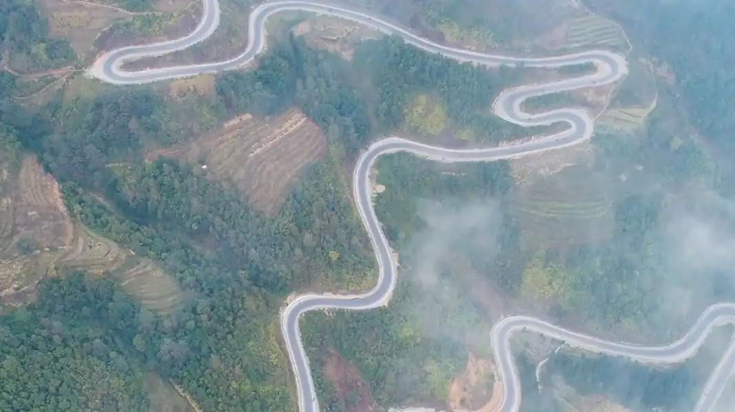
Tham Ma Pass (Dốc Thẩm Mã) is the iconic series of nine zigzag curves winding up an extreme limestone slope between Yen Minh and Dong Van. Historically used to test pack horse stamina, the elevated lookout offers views of ascending motorbikes, local fruit vendors, and roasted mountain snacks.
5. Doc Chin Khoanh (Nine-Turn Pass) and plateau lookouts
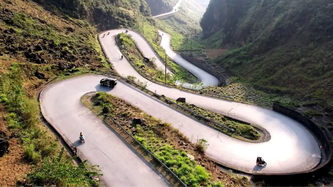
Doc Chin Khoanh scales a jagged cliff face with nine interlocking hairpin curves. Reaching the upper crest introduces travelers to the rocky desert landscape, where local Hmong farmers cultivate corn patches inside miniature crevices among dark limestone pinnacles.
6. Sung La Valley and Pao’s House
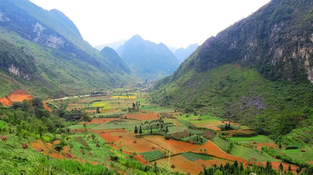
Sung La Valley forms a fertile basin filled with traditional rammed-earth houses (nhà trình tường) and stone boundary fences. The preserved village of Lung Cam gained fame as the filming site for The Story of Pao, featuring clay courtyard homes, textile crafts, and seasonal buckwheat blossoms.
7. Sa Phin and the Hmong King Palace (Dinh Vua Meo)
The fortified Palace of Hmong King Vuong Chinh Duc in Sa Phin Valley showcases an architectural fusion of Chinese, French, and Hmong craftsmanship. Enclosed by towering Chinese fir trees, this century-old stone residence controlled regional trade routes and features defensive bastions and tea pavilions.
8. Dong Van Ancient Town and Sunday Market square
Dong Van town sits at 1,100 meters elevation as the primary commercial hub of the northern plateau. The French-colonial heritage quarter features double-story stone shophouses, 24-hour ATMs, certified fuel stations, and authentic morning eateries serving hot steamed rice rolls (bánh cuốn trứng).
9. Ma Pi Leng Pass and the Tu San Canyon skywalk (Km 170)
Ma Pi Leng Pass ranks among Vietnam four great passes, carved into vertical limestone cliffs 1,500 meters high. The pass looks down onto the emerald Nho Que River within Tu San Canyon, highlighted by the Vietnam National Authority of Tourism as a premier destination with cliffside cafes and boat tours.
10. Du Gia Valley and natural waterfall pool
Du Gia is a peaceful agricultural valley in southern Ha Giang, surrounded by terraced rice fields and freshwater mountain streams. After navigating dry limestone ridges, this lush haven provides restorative natural swimming, authentic Tay and Hmong homestay dinners, and village repair shops.
Comprehensive comparison of major Ha Giang Loop rest stops
| Rest Stop Name | Milestone | Elevation | Facilities | Recommended Stop Purpose |
|---|---|---|---|---|
| Km 0 Milestone | Km 0 | 110 m | ATMs, Cafes | Departure photo and gear check |
| Quan Ba Heaven Gate | Km 43 | 1,050 m | Cafe, Restrooms | Pass summit and valley view |
| Can Ty Lonely Tree | Km 65 | 750 m | Drink Shacks | Photo break away from trucks |
| Tham Ma Pass View | Km 95 | 1,120 m | Stalls, Parking | Photographing zigzag curves |
| Doc Chin Khoanh | Km 108 | 1,280 m | Roadside Stalls | Viewing rocky desert pinnacles |
| Sung La (Pao House) | Km 120 | 950 m | Museum, Cafes | Exploring Hmong earth houses |
| Hmong King Palace | Km 132 | 1,020 m | Heritage Site | Touring colonial stone fortress |
| Dong Van Old Town | Km 155 | 1,100 m | ATMs, Fuel, Food | Overnight rest and regional food |
| Ma Pi Leng Pass | Km 170 | 1,480 m | Cliffside Cafes | Canyon panorama and boat tour |
| Du Gia Waterfall | Km 245 | 420 m | Homestays, Cafes | Swimming and homestay dinner |
Fuel and repair strategy petrol stations and breakdown safety
Managing fuel levels across mountain passes requires disciplined planning, as steep climbs consume 30 to 35 percent more petrol than flat roads. Standard rental bikes feature 3.7 to 4.5-liter tanks, yielding safe mountain ranges of 110 to 130 kilometers before hitting reserve.
Always refuel at certified state-run Petrolimex stations in principal administrative towns:
- Ha Giang City: Main stations before National Road 4C.
- Tam Son (Quan Ba): Station at eastern town exit.
- Yen Minh Town: Essential fuel stop before Tham Ma Pass.
- Dong Van Town: Centrally located station on main street.
- Meo Vac Town: Refueling stop before southern mountain passes.
- Mau Due Intersection: Station before entering Du Gia road.
Roadside bottled gasoline (xăng chai) in recycled glass bottles is common in remote hamlets. Treat bottled fuel solely as an emergency backup, as condensation can clog carburetors. Local repair shops (tiệm vá xe máy) operate in nearly every settlement.
Keep front tires at 29 psi and rear tires at 33 psi for optimal grip on damp limestone roads. To eliminate maintenance stress, explore the benefits of hiring a Ha Giang Easy Rider with a certified mountain driver.
Hygiene, dining and physical recovery guidelines
Restroom standards range from modern tiled facilities at district cafes to basic squat toilets in remote hamlets. Major coffee shops at Quan Ba Heaven Gate, Sung La Valley, Dong Van Ancient Town, and Ma Pi Leng provide clean seated toilets. In small villages, carry personal tissues and hand sanitizer in your daypack.
Dining at roadside eateries (quán cơm bình dân) offers nourishing meals that sustain energy throughout long riding hours. Nutritious lunch stops feature steamed rice with seasonal chayote greens (rau su su xào), free-range chicken, pan-fried tofu, and mild vegetable broth.
Always drink sealed bottled water or hot boiled tea, avoiding unboiled tap water and crushed ice at roadside stalls.
Practice this physical care routine at every 45-minute stop to prevent muscle stiffness and fatigue:
- Complete two minutes of shoulder, neck, and hamstring stretches.
- Drink at least 250 milliliters of clean water or electrolyte fluid.
- Wipe away road dust and insect splatters from your helmet visor.
- Evaluate weather patterns and adjust thermal or waterproof layers.
- Communicate comfort levels and preferred riding pace openly with your driver.
Travelers comparing two-wheel travel against comfortable air-conditioned vehicles can review our comprehensive analysis of the Ha Giang Loop by car or motorbike to determine the best option for their travel party.
Frequently asked questions
Are clean restrooms readily accessible at every rest stop on the Loop?
Clean, modern western-style restrooms operate at established cafes in Ha Giang City, Quan Ba Heaven Gate, Sung La Valley, Dong Van town, and Ma Pi Leng Pass. Smaller mountain huts offer simple squat facilities, making it wise to carry hand sanitizer and pocket tissues throughout your trip.
What happens if my motorcycle runs out of fuel between mountain towns?
If your tank runs dry between district centers, local villagers selling bottled fuel (xăng chai) can provide a liter of petrol to reach the nearest official station. Travelers booking professional guided trips with TVPalm travel with experienced easy riders who monitor tank gauges continuously, eliminating any risk of running out of fuel.
How often should riders take breaks while navigating high mountain passes?
Riders and pillion passengers should schedule a short rest stop every 45 to 60 minutes, or roughly every 25 to 35 kilometers of mountain road. Frequent short pauses prevent lower back cramping, refresh mental alertness, and allow ample time for landscape photography without rushing.
Written by Nguyễn Văn Trung, founder of TVPalm. He has led small-group trips across Northeast Vietnam.
Planning your own Loop? See the TVPalm 3 days 2 nights Ha Giang Loop with an easy rider and hotel or homestay stays along the route.
Not sure what travel insurance to take? Read our travel insurance guide for the Ha Giang Loop and trekking.


